Property Record
4751 Linden Ave, Dayton, OH 45432
NEARBY LISTINGS FOR SALE OR LEASE
Property Detail
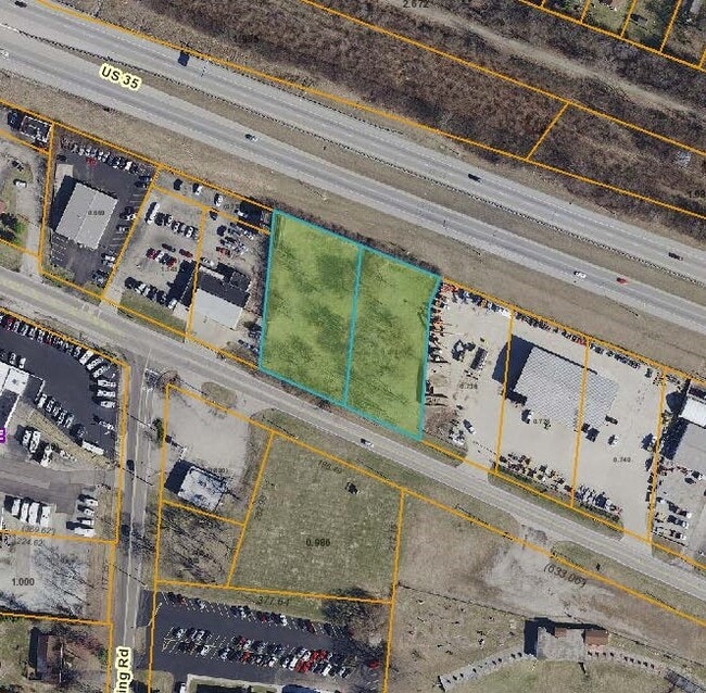
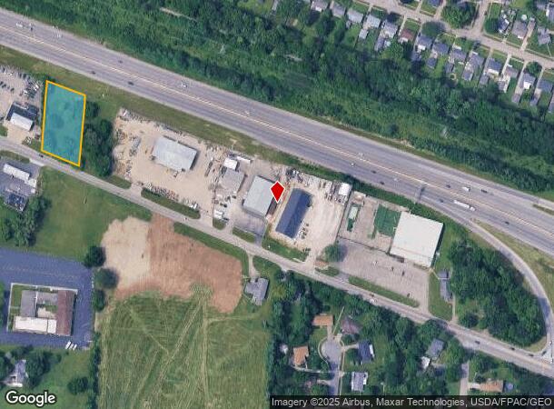
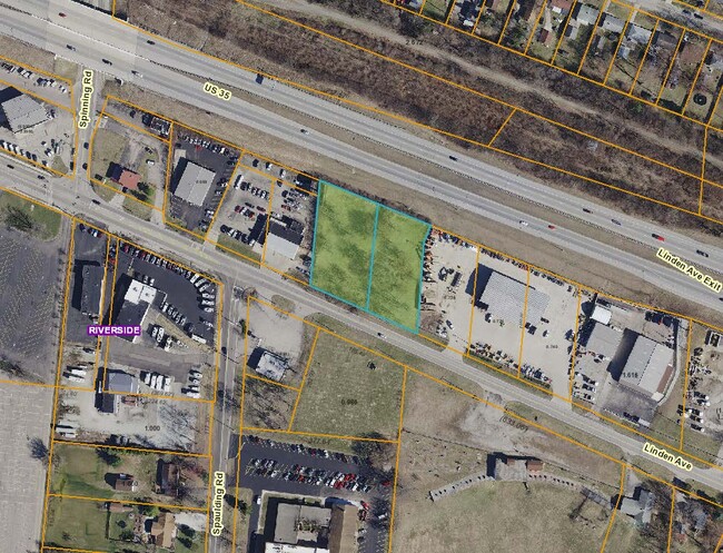
4751 Linden Ave
Dayton, OH
Mrs
I39401505-0010
7-2-15
Commercialacreage
Montgomery
X
Ohio
39113C0276F
10
2023
0.78 AC
2024
South Central Dayton
090900
Cincinnati/Dayton
DEMOGRAPHICS near 4751 Linden Ave
1 Mile
3 Mile
5 Mile
2024 Total Population
8,529
87,452
203,701
2029 Population
8,392
87,337
204,783
Pop Growth 2024-2029
(1.61%)
(0.13%)
+ 0.53%
Average Age
41
39
39
2024 Total Households
3,723
37,797
85,754
HH Growth 2024-2029
(1.75%)
(0.29%)
+ 0.50%
Median Household Inc
$57,968
$55,979
$60,793
Avg Household Size
2.30
2.20
2.20
2024 Avg HH Vehicles
2.00
2.00
2.00
Median Home Value
$132,632
$122,675
$162,815
Median Year Built
1958
1956
1959
Nearby Places
Map Layers
Map Styles
 Street
 Aerial
- Restaurants
- Banks
- Shops
- Fitness
- Groceries
PUBLIC TRANSPORTATION
AIRPORT
James M Cox Dayton International
DRIVE
WALK
Distance
James M Cox Dayton International
28 min
17.1 mi
Freight Ports
Port of Toledo
DRIVE
WALK
Distance
Port of Toledo
185 min
157.3 mi
SALE & LEASE HISTORY
LISTING DATE
SALE/LEASE

Jan 14, 2020
For Sale
Nearby Properties
Address
Land Use
TOTAL SIZE
Lot Size
Zoning
Address
Land Use
TOTAL SIZE
Lot Size
Zoning
316.77 AC
Address
Land Use
TOTAL SIZE
Lot Size
Zoning
752,874 SF
74.85 AC
Address
Land Use
TOTAL SIZE
Lot Size
Zoning
175,938 SF
49.33 AC
Address
Land Use
TOTAL SIZE
Lot Size
Zoning
53.48 AC
RP1
Address
Land Use
TOTAL SIZE
Lot Size
Zoning
130,247 SF
14.12 AC
Address
Land Use
TOTAL SIZE
Lot Size
Zoning
Address
Land Use
TOTAL SIZE
Lot Size
Zoning
133.37 AC
Address
Land Use
TOTAL SIZE
Lot Size
Zoning
3,243 SF
22.88 AC
R-PUD 97-3
Address
Land Use
TOTAL SIZE
Lot Size
Zoning
88,522 SF
12.96 AC
Address
Land Use
TOTAL SIZE
Lot Size
Zoning
46,796 SF
53.05 AC
RPUD038
Address
Land Use
TOTAL SIZE
Lot Size
Zoning
41.38 AC
Address
Land Use
TOTAL SIZE
Lot Size
Zoning
54.85 AC
Address
Land Use
TOTAL SIZE
Lot Size
Zoning
46.32 AC
Address
Land Use
TOTAL SIZE
Lot Size
Zoning
32.30 AC
Address
Land Use
TOTAL SIZE
Lot Size
Zoning
4.98 AC
Address
Land Use
TOTAL SIZE
Lot Size
Zoning
96,732 SF
6.73 AC
CPUD002
Address
Land Use
TOTAL SIZE
Lot Size
Zoning
94,608 SF
7.44 AC
Address
Land Use
TOTAL SIZE
Lot Size
Zoning
406,186 SF
36.48 AC
Address
Land Use
TOTAL SIZE
Lot Size
Zoning
76,038 SF
12.59 AC
CPUD971
Address
Land Use
TOTAL SIZE
Lot Size
Zoning
89,176 SF
17.52 AC
Address
Land Use
TOTAL SIZE
Lot Size
Zoning
45,954 SF
9.46 AC
Address
Land Use
TOTAL SIZE
Lot Size
Zoning
309,331 SF
36 AC
Address
Land Use
TOTAL SIZE
Lot Size
Zoning
9,216 SF
16.77 AC
RPUD891
Address
Land Use
TOTAL SIZE
Lot Size
Zoning
23.20 AC
Address
Land Use
TOTAL SIZE
Lot Size
Zoning
24,992 SF
17 AC
MULTIPLE
Address
Land Use
TOTAL SIZE
Lot Size
Zoning
20,144 SF
76.94 AC
A1
Address
Land Use
TOTAL SIZE
Lot Size
Zoning
73,040 SF
12.99 AC
RPUD901
Address
Land Use
TOTAL SIZE
Lot Size
Zoning
1,200 SF
4.25 AC
B3
Address
Land Use
TOTAL SIZE
Lot Size
Zoning
Address
Land Use
TOTAL SIZE
Lot Size
Zoning
89,082 SF
4.61 AC
The World's #1 Commercial Real Estate Marketplace
Connect with us
© 2025 CoStar Group
The information above has been obtained from sources believed reliable. While we do not doubt its accuracy we have not verified it and make no guarantee, warranty or representation about it. It is your responsibility to independently confirm its accuracy and completeness. Any projections, opinions, assumptions, or estimates used are for example only and do not represent the current or future performance of the property. The value of this transaction to you depends on tax and other factors which should be evaluated by your tax, financial, and legal advisors. You and your advisors should conduct a careful, independent investigation of the property to determine to your satisfaction the suitability of the property for your needs.